Mapping Brightside’s Properties on Indigenous Land
Contextualizing the Cultural and Historical Significance of the Stolen Land on which We Provide Homes
Brightside Community Homes Foundation made a commitment to reconciliation in recognition of the Truth and Reconciliation Commission’s 2015 report and the resulting 94 calls to action. Brightside is committed to building long-term mutually beneficial relationships with Indigenous people and Indigenous communities. Brightside honours and respects Traditional Territories of all Indigenous communities and the social, cultural, and spiritual identity Indigenous people have as a connection to these lands.
Brightside sought the assistance of Charla Huber, Indigenous Communications & Indigenous Relations Specialist, to assist with identifying Indigenous geography, significance, and history of all Brightside’s land and assets. This project adheres to Brightside’s strategic goals, aids in the education of the Brightside team, stakeholders, and the public, and signifies respect for the Squamish, Musqueam, and Tsleil-Waututh Nations and community members.
The intention of this document is to provide context for Brightside’s work, as a place-based organization, to understand the cultural significance of the land on which we provide homes, and to invest in how we, as an organization, can take meaningful steps in the exploration of reconciliation and enactment of the National Centre for Truth and Reconciliation’s Calls to Action.
Brightside extends our sincerest thanks to Charla for providing her extensive experience, immense skill, and valuable insight in this work.

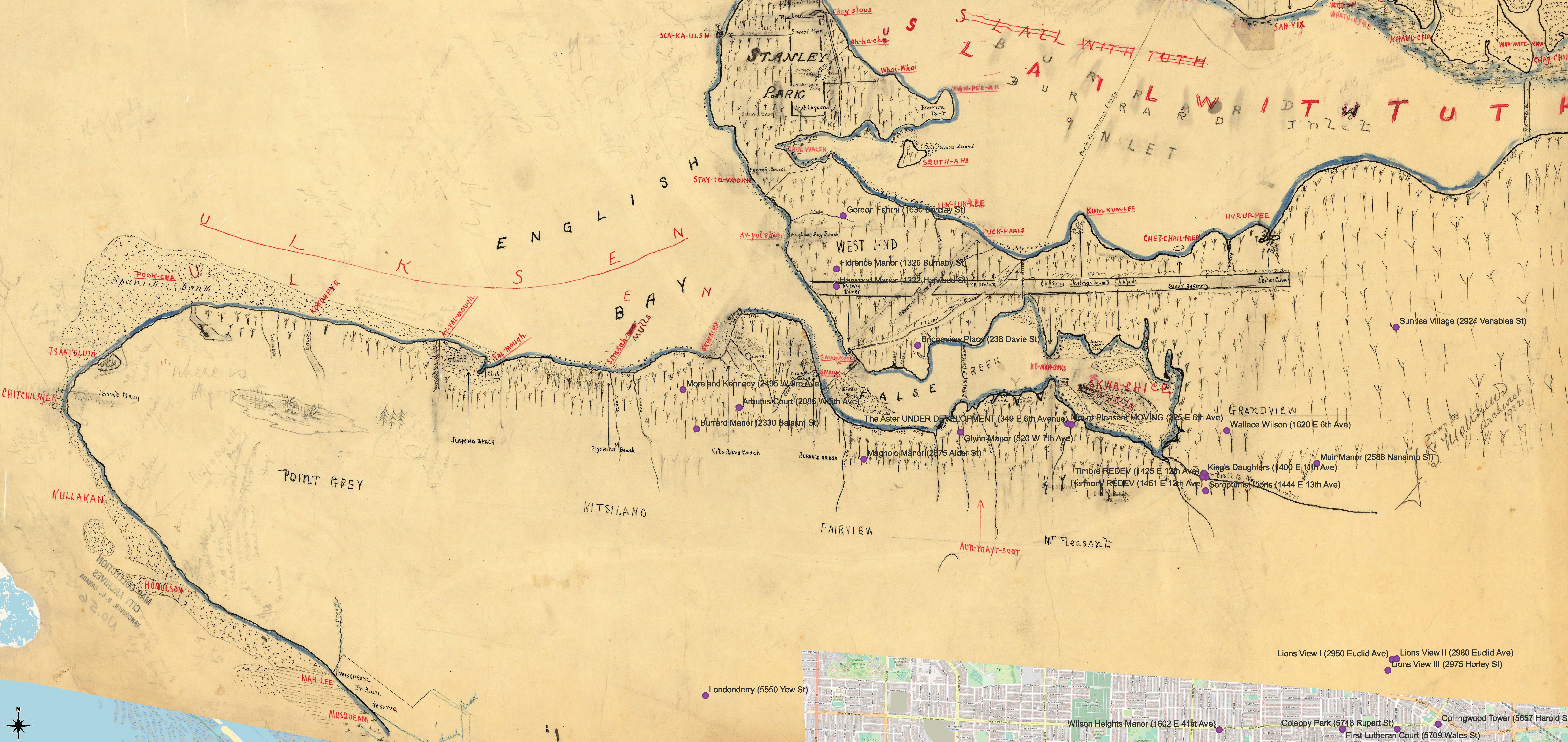
Draft map depicting Burrard Inlet and English Bay – Major J S Matthews collection, Vancouver Archives. Original document available online here.
Georeferenced to contextualize Brightside properties on Indigenous land using QGIS.
Some of the research and maps that make up this work rely on modern resources and material, as well as on colonial sources such as map collections available in the City of Vancouver Archives. Maps available in the Major Matthews collection at the Vancouver Archives are one such resource, contextualized in compilations like Conversations with Khahtsahlano. While these sources are neither primary nor geographically precise, they do provide valuable insight into the pre-contact and early post-contact context of the land that is now referred to as “Vancouver.”
Click HERE to download a PDF copy of the mapping document (opens in a new window).
